Difference between revisions of "User talk:Valaggar/PlanetBox"
Jump to navigation
Jump to search
| Line 12: | Line 12: | ||
::While the advanced scalers tend to look less pixelated, there is a problem with trimming the grey border. With any of the scalers, the border and topomap bleed together for a few rows/columns of pixels. I'd be more in favor of using the unscaled topomaps, like we did for the alien artifacts (granted it was easier for those since the raw images existed and were easily accessible). And since its the rawest data, anyone can then go and easily apply the various algorithms to create a smoothed out image; unconvoluting a scaled image on the other hand is a pain - though I don't know how or if the same argument holds up for the 3d planet image. But since that's generated from the topomap (and the 3d image generation has changed significantly for UQM), I think a good compromise would be to use the HQ, high-res 3d image, and the none-scaled, low-res topomap. Oh and don't worry, I'm only tinkering around with a single topomap, checking out the various resolutions and scalers. And with that, I'm off to work. --[[User:Fyzixfighter|Fyzixfighter]] 17:34, 2 May 2007 (CEST) | ::While the advanced scalers tend to look less pixelated, there is a problem with trimming the grey border. With any of the scalers, the border and topomap bleed together for a few rows/columns of pixels. I'd be more in favor of using the unscaled topomaps, like we did for the alien artifacts (granted it was easier for those since the raw images existed and were easily accessible). And since its the rawest data, anyone can then go and easily apply the various algorithms to create a smoothed out image; unconvoluting a scaled image on the other hand is a pain - though I don't know how or if the same argument holds up for the 3d planet image. But since that's generated from the topomap (and the 3d image generation has changed significantly for UQM), I think a good compromise would be to use the HQ, high-res 3d image, and the none-scaled, low-res topomap. Oh and don't worry, I'm only tinkering around with a single topomap, checking out the various resolutions and scalers. And with that, I'm off to work. --[[User:Fyzixfighter|Fyzixfighter]] 17:34, 2 May 2007 (CEST) | ||
:::You've got the point here. Don't worry, I'll do the grunt work. My plan is to take the shots with no scaler and apply a 100% Low Pass with a radius of 2 pixels, and it looks much better than with any scaler, plus with no cut columns or rows. [[User:Valaggar|Valaggar]] 17:46, 2 May 2007 (CEST) | :::You've got the point here. Don't worry, I'll do the grunt work. My plan is to take the shots with no scaler and apply a 100% Low Pass with a radius of 2 pixels, and it looks much better than with any scaler, plus with no cut columns or rows. [[User:Valaggar|Valaggar]] 17:46, 2 May 2007 (CEST) | ||
| + | :::EDIT: BTW, the HQ scaler does not cut any columns or rows, it's just an illusion. Anyway, I feel that the low pass works better. I don't know if you agree, though. Uploaded Gamma Serpentis I with Low Pass from No Scaler for comparison: [[Image:Expepix.jpg]] <br> and here is the HQ Gamma Serpentis I: [[Image:gammaserpentisiMap.jpg]] <br> Hmm... maybe the HQ version is the best, now that I glance upon the image again. [[User:Valaggar|Valaggar]] 17:58, 2 May 2007 (CEST) | ||
Revision as of 15:58, 2 May 2007
To continue some of the discussion here rather than clutter up Svdb's page - If I can interject some thoughts on this, it might look better with the "type" box beneath the planetary data - also i don't think it's necessary to say what the satellite types are just how many of them there are. This field could be merged into the planetary data section. Also as to the map size, I'd recommend 242x75, the size of the eartmask.png, or 232x67, the size of the orview.19.png. I couldn't find any other set example of a map in the UQM content files though. That said, do you mind if I or others tweak this page a bit to experiment with the appearance? --Fyzixfighter 10:44, 1 May 2007 (CEST)
- You can tweak it how you want.
- As to satellite types - well, it makes a BIG difference to look at the sky and see a Water World moon, for example. And it doesn't clutter the PlanetBox at all. Just a few extra characters.
- Planet type box moved below detailed data.
- Speaking of merging the satellite data with data on the planet - well, you can see it better in the planet type box, as it's related to the "planet at a glance" information rather than detailed data.
- I don't know what's up with eartmask.png, but if you zoom in to the topomaps here you can see that there are no macropixels (former pixels divided into multiple pixels). I guess this is because of the scaler, but it looks better at the current resolution. Valaggar 11:10, 1 May 2007 (CEST)
- Hey Val, what were the graphic settings you were using when you took the topomap images? I'm trying to compare how these look at different settings. Just FYI, using the lowest resolution (equivalent to the original SC2) the images are 242x75 like the eartmask.png. --Fyzixfighter 06:44, 2 May 2007 (CEST)
- 1024x768. Windowed, if this matters. Valaggar 14:10, 2 May 2007 (CEST)
- Thanks - Which scaler was it using? --Fyzixfighter 16:08, 2 May 2007 (CEST)
- HQ. As a side note (17:05 CEST), I can re-take the screenshots, there's no need to do it yourself. Valaggar 16:53, 2 May 2007 (CEST)
- Thanks - Which scaler was it using? --Fyzixfighter 16:08, 2 May 2007 (CEST)
- 1024x768. Windowed, if this matters. Valaggar 14:10, 2 May 2007 (CEST)
- While the advanced scalers tend to look less pixelated, there is a problem with trimming the grey border. With any of the scalers, the border and topomap bleed together for a few rows/columns of pixels. I'd be more in favor of using the unscaled topomaps, like we did for the alien artifacts (granted it was easier for those since the raw images existed and were easily accessible). And since its the rawest data, anyone can then go and easily apply the various algorithms to create a smoothed out image; unconvoluting a scaled image on the other hand is a pain - though I don't know how or if the same argument holds up for the 3d planet image. But since that's generated from the topomap (and the 3d image generation has changed significantly for UQM), I think a good compromise would be to use the HQ, high-res 3d image, and the none-scaled, low-res topomap. Oh and don't worry, I'm only tinkering around with a single topomap, checking out the various resolutions and scalers. And with that, I'm off to work. --Fyzixfighter 17:34, 2 May 2007 (CEST)
- You've got the point here. Don't worry, I'll do the grunt work. My plan is to take the shots with no scaler and apply a 100% Low Pass with a radius of 2 pixels, and it looks much better than with any scaler, plus with no cut columns or rows. Valaggar 17:46, 2 May 2007 (CEST)
- EDIT: BTW, the HQ scaler does not cut any columns or rows, it's just an illusion. Anyway, I feel that the low pass works better. I don't know if you agree, though. Uploaded Gamma Serpentis I with Low Pass from No Scaler for comparison:
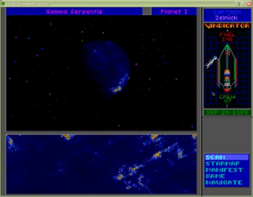
and here is the HQ Gamma Serpentis I: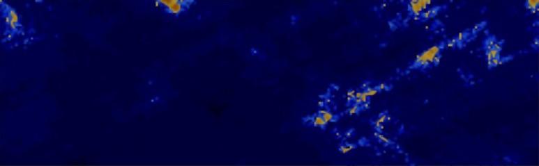
Hmm... maybe the HQ version is the best, now that I glance upon the image again. Valaggar 17:58, 2 May 2007 (CEST)
- Hey Val, what were the graphic settings you were using when you took the topomap images? I'm trying to compare how these look at different settings. Just FYI, using the lowest resolution (equivalent to the original SC2) the images are 242x75 like the eartmask.png. --Fyzixfighter 06:44, 2 May 2007 (CEST)

